
The Window
The window has three areas: the sidebar on the left, a list for the current feature in the middle, and the content on the right. At the top of the sidebar are four workspaces; picking one lists its features below.
| Workspace | Features |
|---|---|
| Data | Tracks, Trip Shares, File Manager, Summit Log |
| Edit | Point Editor, Replay Editor, Photo Match, GPS Cleanup |
| Output | Trip Brief, Print Map |
| Maps | Map Packs (offline maps, contours and hillshade) |
Data
Features:Tracks, Trip Shares, File Manager, Summit Log
Edit
Features:Point Editor, Replay Editor, Photo Match, GPS Cleanup
Output
Features:Trip Brief, Print Map
Maps
Features:Map Packs (offline maps, contours and hillshade)
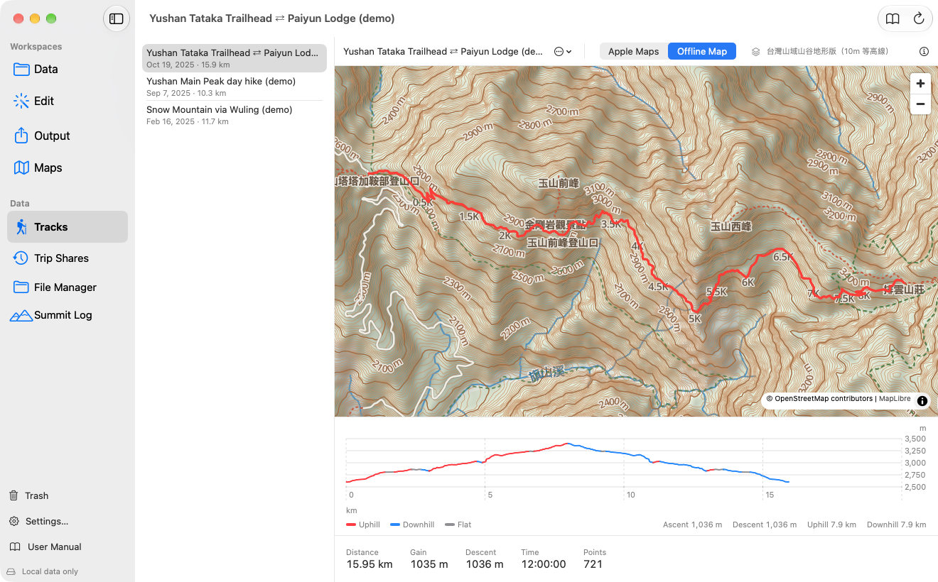
- 1The four workspaces: Data, Edit, Output and Maps.
- 2The features of the current workspace; click one to switch.
- 3The list: choose the track or route to work on.
- 4Toolbar: basemap, menus and help.
- 5Statistics: distance, ascent, descent, time and point count.
- 6Trash, Settings and this manual are at the bottom of the sidebar.
Where Your Data Comes From
AkiMap Desktop has no database of its own. It reads and writes the tracks, routes, photos, voice memos and summit records that the iPhone app syncs through iCloud. A hike you record on the iPhone shows up on the Mac a little later, and edits you make on the Mac sync back to the iPhone.
- On the iPhone, open Aki Map ▸ Settings and turn on iCloud sync.
- On the Mac, open AkiMap Desktop, signed in to the same Apple Account.
- Wait until the status line at the bottom of the sidebar says “iCloud connected”.
- If data does not appear, press ⌘R or the reload button in the toolbar.
Language and Text Size
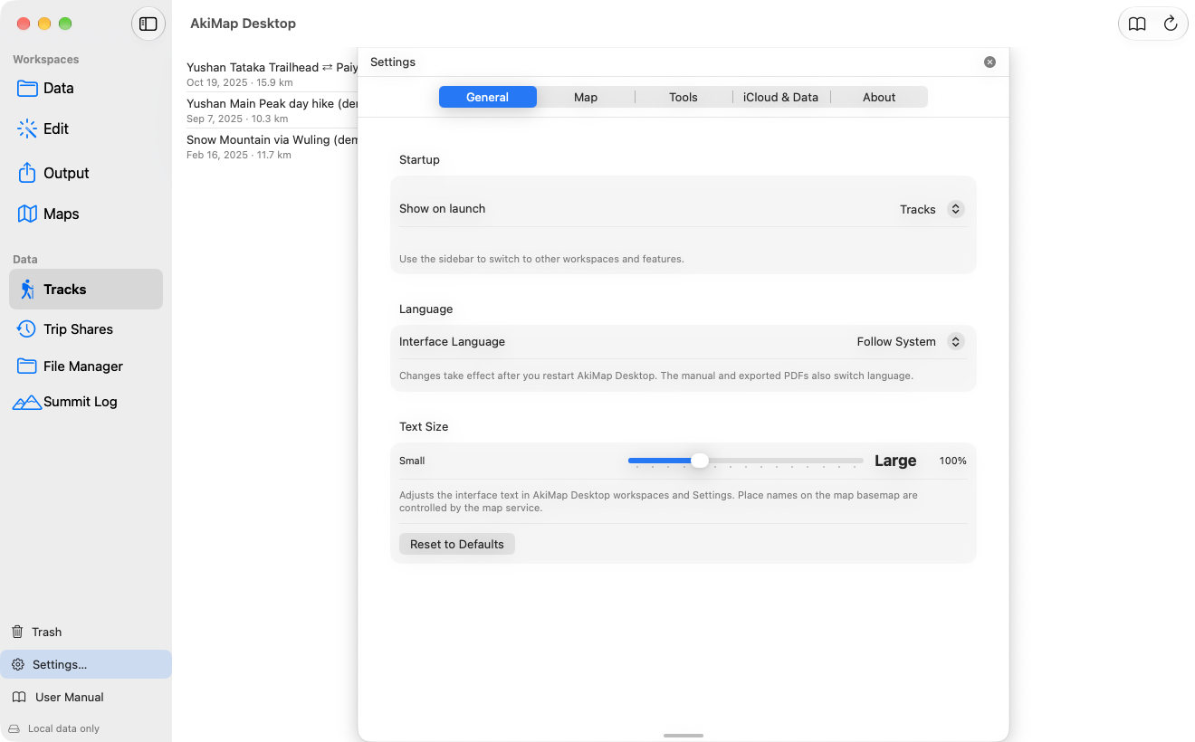
The interface follows the macOS language by default and supports Traditional Chinese and English. To fix a language, go to Settings ▸ General ▸ Interface Language and restart the app. This manual and exported PDFs switch language too.
Settings ▸ General ▸ Text Size scales the whole app (80%–150%). Place names on the map basemap come from the map service and do not follow the language setting; peak names in the Summit Log are always shown in Chinese.
Using This Manual
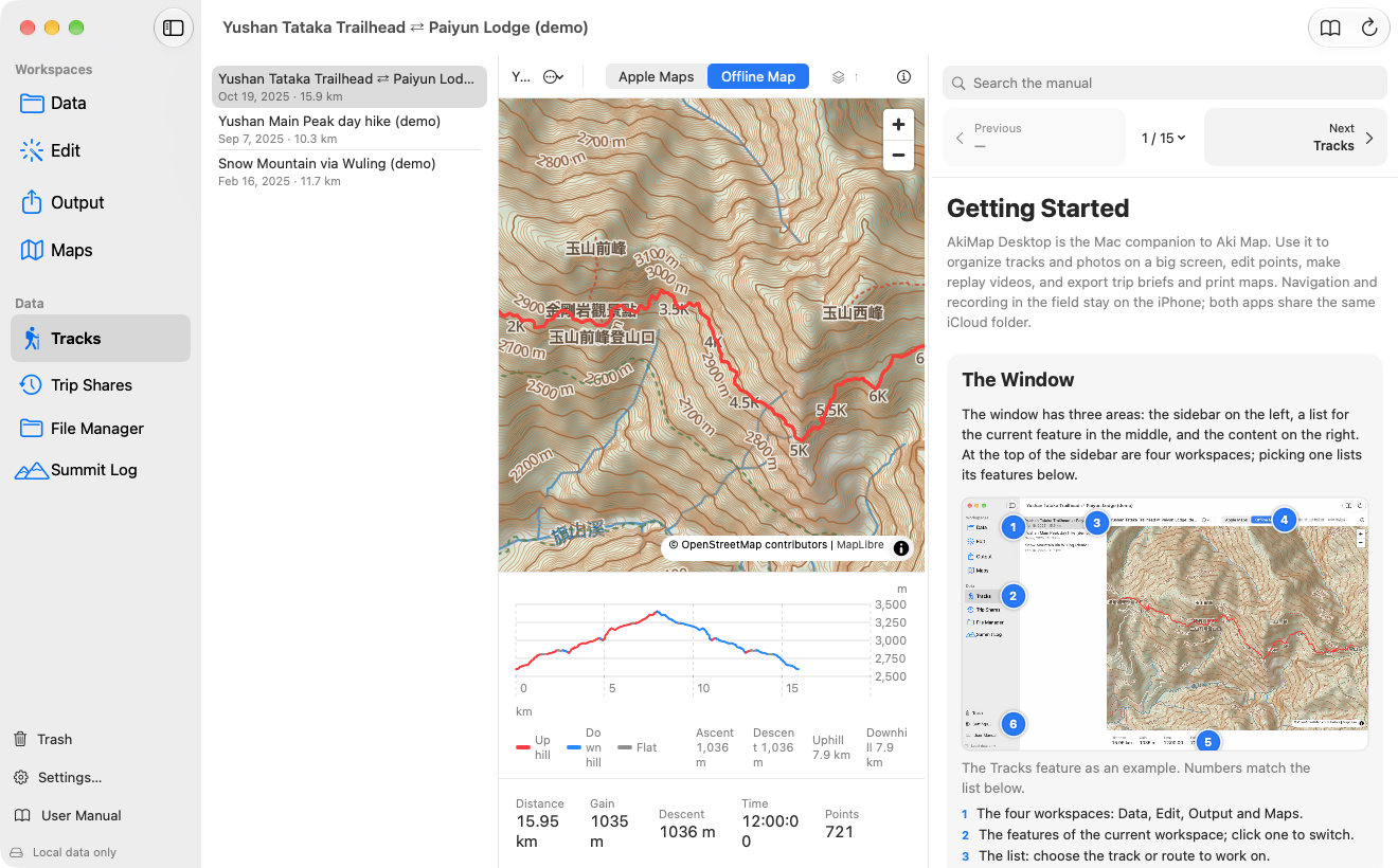
- Press ⌘?, click the book button in the toolbar, or click “User Manual” at the bottom of the sidebar. The manual slides out as a panel on the right of the main window; use the same control to close it. Drag the panel’s left edge to resize it; the app remembers its width and whether it is open.
- Type in the search field at the top of the panel to search every chapter at once. With several words separated by spaces, only sections containing all of them are listed.
- Click a picture to enlarge it. The numbered dots on a picture match the notes below it.
- Blue links such as Trash jump to the related chapter.
Keyboard Shortcuts
| Shortcut | Action |
|---|---|
| ⌘R | Reload iCloud data |
| ⌘S | Save (Point Editor, Replay Editor) |
| ⌘Z / ⇧⌘Z | Undo / Redo (Point Editor) |
| ⌘, | Open Settings |
| ⌘? | Open this manual |
⌘R
Action:Reload iCloud data
⌘S
Action:Save (Point Editor, Replay Editor)
⌘Z / ⇧⌘Z
Action:Undo / Redo (Point Editor)
⌘,
Action:Open Settings
⌘?
Action:Open this manual
What Needs the Internet
| Feature | Internet needed? |
|---|---|
| Browsing tracks (offline map), point editing, GPS cleanup, photo matching | No (only when using the Apple Maps basemap) |
| Trip brief, print map, replay video export | Yes: map tiles are fetched from Apple |
| Downloading and updating map packs | Yes |
| iCloud sync | Yes |
Browsing tracks (offline map), point editing, GPS cleanup, photo matching
Internet needed?:No (only when using the Apple Maps basemap)
Trip brief, print map, replay video export
Internet needed?:Yes: map tiles are fetched from Apple
Downloading and updating map packs
Internet needed?:Yes
iCloud sync
Internet needed?:Yes
Screens may vary by app version. See Support and FAQ if you need help. Support